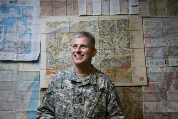
Army Geospatial Engineers (MOS 12Y) use geographic data that supports military and civilian operations.
As a result, they work closely with Disaster Relief and Homeland Security.
An Army Geospatial Engineer (MOS 12Y) collects, analyzes, and distributes geospatial information regarding the terrain and its possible effects.
Learn more about the education, training, job duties, salary, and job outlook for an Army Geospatial Engineer MOS 12Y.
Jump To A Section
What does a Geospatial Engineer do?
Pay and Benefits
Job Reviews
Civilian Career Opportunities
Summary
Education, Qualifications,Training and Duty Stations
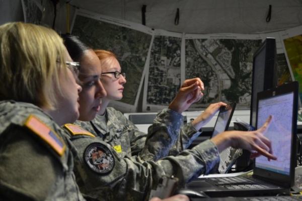
Army Geospatial Engineers are needed to use geographic data to create maps.
It assists commanders with understanding the layout of a battlefield.
Additionally, the information is used in military briefs and civilian operations.
Related Article – Army MOS List: A List Of All 159 Army Jobs
Education
In order to join the U.S. Army, you must have a high school diploma or GED equivalent.
Your local Army recruiter can let you know other things you need to make yourself aware of before joining the Army, such as APFT standards.
You need to complete the Armed Services Vocational Aptitude Battery (ASVAB) to learn the strengths and weaknesses related to military careers.
Those that are interested in becoming Army Geospatial Engineers (MOS 12Y) must score 100 on Skilled Technical (ST) and 100 on General Technical (GT).
New recruits interested in MOS 12Y are also tested in General Science (GS), Word Knowledge and Paragraph Comprehension (VE), Mechanical Comprehension (MC), and Mathematics Knowledge (MK).
Related Article – Air Force Geospatial-Intelligence (1N131): Career Profile
Qualifications
Army Geospatial Engineers need to have normal color vision.
It also helps to have an interest in geography, science, and math.
Of course, the desire to create maps and charts is a big part of the job, so having a natural interest in maps and charts goes a long way.
It is also recommended that MOS 12Y understand basic computer skills and will learn more about using drafting equipment while in the U.S. Army.
Army Geospatial Engineers are technical experts that can conceptualize ideas and present them on computer-generated 2D and 3D images or products.
Also, since MOS 12Y collects sensitive information that can have an impact on combat operations there is security clearance you need to attain.
The Army grants clearance to members that demonstrate outstanding character and personal conduct.
The background check is extensive and will consider your finances, any criminal activity, as well as your emotional and mental well-being.
Related Article – Army Combat Engineer (MOS 12B): Career Details
Training
Now that you know more about the education and qualification requirements of MOS 12Y let’s look into the training.
All Army recruits spend 10 weeks in basic combat training, or boot camp.
Army Geospatial Engineers spend an additional 20 weeks in Advanced Individual Training.
The advanced training is a combination of classroom learning and on the field training with on-the-job instruction.
You will learn about Geographic Information Systems (GIS), geographic analysis, and imagery interpretation and exploitation.
Army Geospatial Engineers (MOS 12Y) also learn how to prepare for military briefings with commanding officers.
Duty Stations
Those serving in the Army as an MOS 12Y can expect to be potentially based at one of the following duty stations:
Inside the Continental US (CONUS)
- Ft. Benning, GA
- Ft. Bliss, TX
- Ft. Bragg, NC
- Ft. Campbell, KY
- Ft. Carson, CO
- Ft. Drum, NY
- Ft. Eglin, FL
- Ft. Gordon, GA
- Ft. Hood, TX
- Ft. Hunter, CA
- Ft. Leonard Wood, MO
- Ft. Lewis, WA
- Ft. MacDill, FL
- Ft. Peterson, CO
- Ft. Polk, LA
- Ft. Riley, KS
- Ft. Sam Houston, TX
- Ft. Sill, OK
- Ft. Stewart, GA
Outside the Continental US (OCONUS)
- Ft. Richardson, AK
- Ft. Wainwright, AK
- Katterbach, Germany
- Rhine, Germany
- Wiesbaden, Germany
- Vilseck, Germany
- Hickam, HI
- Schofield, HI
- Shafter, HI
- Vicenza, Italy
- Casey, South Korea
- Humphreys, South Korea
- Hovey, South Korea
- Red Cloud, South Korea
- Yongsan, South Korea
What does an Army Geospatial Engineer Do?
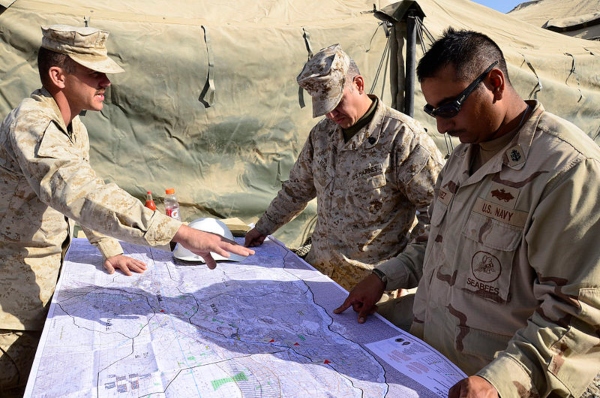
An Army Geospatial Engineer (MOS 12Y) is vital to the collection of sensitive geographic data as well as presenting that information to commanding officers.
Army Geospatial Engineers need to collect, analyze, and distribute geospatial information to officers in order to inform them of critical aspects of the terrain.
The role is especially important during battlefield operations, especially in new surroundings.
Related Article – Army Airborne School: Requirements, Length, Packing List, And More
Collecting Geographic Data
Army Geospatial Engineers are tasked with extracting data from satellite imagery, field reconnaissance, and aerial photography.
They use these instruments to collect geographic data so they can begin to put together a report for commanding officers.
The geospatial information is analyzed in order to put together the best means to present it to a larger audience, such as during a military briefing.
Distributing Geographic Data
Once geospatial information is collected and analyzed the duty of MOS 12Y is to distribute the information using the most suitable means.
Maps and charts are the best allies of an Army Geospatial Engineer and are easy to understand visual representations.
There is also a need to create 2D and 3D images or products.
Furthermore, Army Geospatial Engineers will create and maintain multiple geospatial databases for future reference.
Leading Military Briefs
A military brief is a meeting with commanding officers and other personnel to present information they need to learn about upcoming operations.
Army Geospatial Engineers (MOS 12Y) are needed during briefings to help commanders visualize the battlefield.
They are especially important when the Army has moved troops to a new area where they are unfamiliar with the setting.
As a result, you will spend time speaking in front of others where good communication and presentation skills are important.
Thanks to your hard work you will inform and train a squadron on everything they need to know about the terrain they are set to embark upon.
Army Geospatial Engineers commonly assist not only the military but also the Department of Homeland Security and civilian disaster relief groups.
What does an Army Geospatial Engineer make?
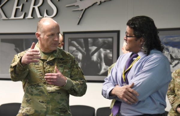
Geospatial Engineers are paid based on Army rank and years of service.
It is the same with all other military jobs in the U.S. Army.
It doesn’t matter the job title, what matters in terms of pay is how long you have been part of the organization.
Here is a general breakdown of what you can expect to make based on Army rank:
| Insignia | Pay Grade | Rank | Abbreviation | Minimum Monthly Pay |
|---|---|---|---|---|
| E-1 +4 months | Private | PVT | $1,917.60 | |
| E-2 | Private Second Class | PV2 | $2,149.20 | |
| E-3 | Private First Class | PFC | $2,259.90 | |
| E-4 | Specialist | SPC | $2,503.50 | |
| E-4 | Corporal | CPL | $2,503.50 | |
| E-5 | Sergeant | SGT | $2,730.30 | |
| E-6 | Staff Sergeant | SSG | $2,980.50 | |
| E-7 | Sergeant First Class | SFC | $3,445.80 | |
| E-8 | Master Sergeant | MSG | $4,957.20 | |
| E-8 | First Sergeant | 1SG | $4,957.20 | |
| E-9 | Sergeant Major | SGM | $6,055.50 | |
| E-9 | Command Sergeant Major | CSM | $6,055.50 | |
| E-9 | Sergeant Major of the Army | SMA | $6,055.50 |
Related Article – Army Ranks and Pay
Benefits
The U.S. Army has several benefits included with a monthly salary:
- Medical Insurance
- Vacation Time
- Special Pay
- Retirement
- Housing: Allowances for living expenses, utilities, and maintenance.
- Food: Allowance for the on-base dining hall and access to tax-free department and grocery stores
- Education: Army members can earn full-tuition, merit-based scholarships, allowances for books and fees, plus an annual stipend for living expenses.
It also worth mentioning that you can earn up to $40,000 in cash bonuses for enlisting under certain Military Occupational Specialties (MOS) in certain places.
The Army has a list of jobs that are currently in high demand with cash incentives.
Additionally, anything in the Geospatial job niche can lead to a lucrative career once your time in the Army is up!
Job Reviews
The position of MOS 12Y Geospatial Engineer has received generally favorable job reviews on dependable career sites like Indeed.com and GlassDoor.com.
One reviewer summarized life in the military the best when he or she explained there are very few other organizations in the world where your co-workers would give their life for yours in an instant:

Those that became Army Geospatial Engineers also mentioned that the essentially free education you receive for the career is outstanding.
MOS 12Y learn how to use Geographic Information Systems (GIS), which is an important tool to have for today’s job market:

Though you’ll have a second family with the military, it is difficult for your first family.
A common complaint among service members in the military, regardless of job or branch is being away from a significant other and/or children for extended periods of time.
Related Article – 10 Benefits Of Being A Military Wife (and 5 not-so good things)
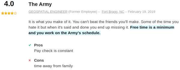
As one poster mentioned – “free time is minimal” and your schedule is secondary compared to the schedule of the U.S. Army:
At the end of the day, it is impossible to beat all the amazing benefits of the U.S. Army as well as the opportunity to see the world.

Civilian Job Opportunities
The ability to use Geographic Information Systems (GIS) is in hot demand in present society.
There are many esteemed universities that have added a GIS program within the last decade.
As a result, you can learn about GIS equipment and solutions while serving the United States Armed Forces.
The education and training you receive, as well as direct real-life experience will prepare you well for a civilian career.
Though many aspects of MOS 12Y are specific to the military, you can still use the skills attained to work in the construction industry or for a surveying company.
The computer programs you will learn in the U.S. Army are also used by civilian companies such as architecture firms.
Army Geospatial Engineers often move on to become Civil Engineers (average yearly salary $86,640), Geographers (average yearly salary $80,300), or Surveyors (average yearly salary $62,580).
You may want to consider joining the Army PaYS program for guaranteed job interviews and other helpful civilian job resources post-military.
Summary
Geospatial Engineers (MOS 12Y) are important to the daily operations of the U.S. Army.
An Army Geospatial Engineer will use geographic data to brief commanding officers after collecting and analyzing the information.
There is a growing need for the ability to use Geographic Information Systems (GIS) in the real world, which also makes the civilian job outlook for MOS 12Y very good.
Resources:
- https://www.goarmy.com/careers-and-jobs/browse-career-and-job-categories/construction-engineering/geospatial-engineer.html
- https://www.hrc.army.mil/content/Geospatial%20Engineer
- https://www.indeed.com/cmp/U.S.-Army/reviews?fcountry=ALL&fjobtitle=Geospatial+Engineer&ftopic=wlbalance
- https://www.glassdoor.com/Job/us-geospatial-engineer-12y-jobs-SRCH_IL.0,2_IN1_KO3,26.htm
- Ikon Pass Military Discount: Learn How To Save Big - January 31, 2025
- RTIC Military Discount: Find Out How To Save Big on Gear - January 30, 2025
- Traeger Military Discount: Learn How To Save Big on Smokers - January 28, 2025

